Hydrogeology of Coastal Aquifers of Southeast Massachusetts: Assessment of the impacts of the combined effects of sea-level rise and terrestrial climate change

Recent Updates
Groundwater model, salinity, and stratigraphic update
By
Alexander Kirshen
on March 9, 2023
The major updates to the groundwater flow model are: (1) the grid for the groundwater flow model is finalized, and (2) a density-dependent model was run to represent the salinity distribution in the aquifer. In the zone most likely to experience saltwater intrusion (8 to -32 meters above sea level), the grid cells have a finer vertical spacing to detect precise changes in saltwater intrusion. In Figure 1, the interface between saltwater and freshwater can be seen near the coast, with more dense ocean water (red) flowing under the less dense freshwater (blue).
Groundwater Model Update
By
Alexander Kirshen
on January 9, 2023
(updated January 10, 2023)
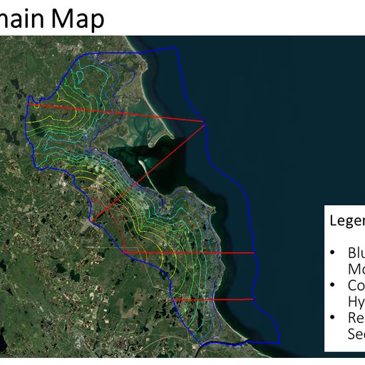
We developed a homogenous density-dependent groundwater model simulating groundwater flow in bedrock and overburden sediments. As seen in the image of the cross-sections, an interface forms between the more dense ocean water (red) and the less dense freshwater (blue). Also included is an image of the modeled hydraulic head; you can see that the hydraulic head decreases moving toward the coast (east). In this aquifer system, hydraulic head can be thought of as the elevation of the water table. We are now revising the stratigraphic framework for the region using state well logs which will be incorporated in future model simulations.


